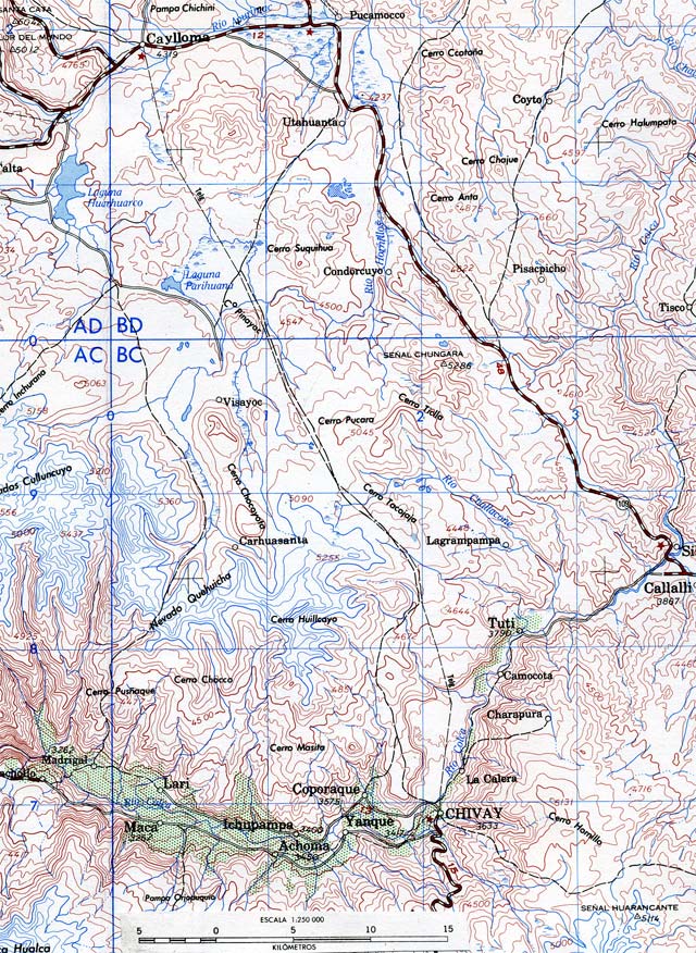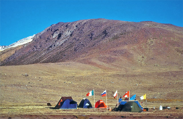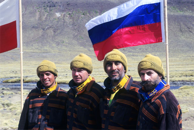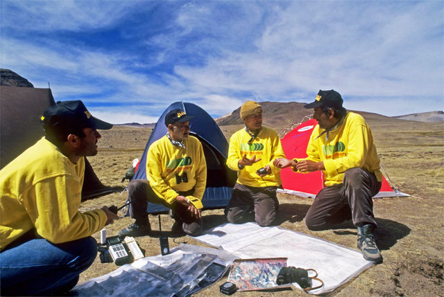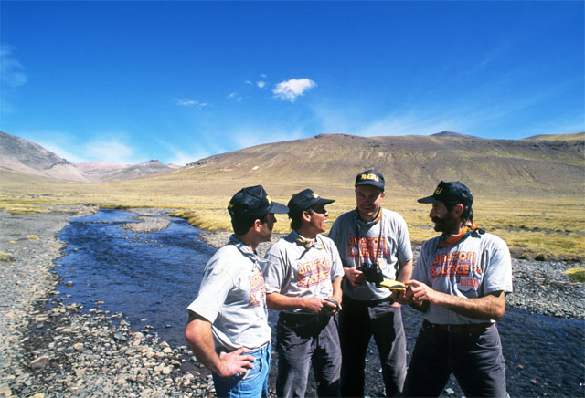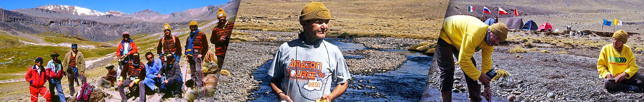
After a great deal of debate and controversy, the source of the largest river in the world has finally been located according to scientific criteria. One of the least known puzzles at the end of the millennium concerned the exact position where the Rio of the Amazons first comes to the surface. Its source had never been located with certainty and had always been the subject of heated discussions between geographers and explorers. In the background of all this uncertainty, we decided to organize an exciting and ambitious expedition. In order to begin from a scientific foundation, we first studied various university texts, the results of inquires and archive research. So it was in the summer of 1996 that we embarked on an expedition in collaboration with the Peruvian Geographical Society, the Catholic University of Lima, the Russian Academy of Sciences and the Department of the Peruvian Navy.
Historically speaking, the Maranon River had always been considered the main tributary of the Amazon. It was explored and described as early as the eighteenth century by Jesuit Father Samuel Fritz. In 1934, Colonel Gerardo Andreas, after carrying out topographic surveys on the Cordillera Chile in the Caylloma district, put forward his own theory: only the Ucayali, even though it had three times less the water volume than the Maranon, could be the source for the largest river in the world. What in fact counted was its greater length.
According to Andreas, the Ucayali flowed out of the Apurimac, whose source was on the south-western slope of Mount Huagra. Yet his theory only began to be accepted by geographers around twenty years later.
In 1978, the great Walter Bonatti set off on his own personal expeditions to explore the stream called the Huarajo. Several explorers claimed, however, that the Amazon did not arise on Mount Huagra but on Mount Minaspata, or in Lake Vilafro, while Carlos Penaherrera del Aguila in 1979, claimed that the source was 5,597 meters high on Nevado Mismi, in the Province of Caylloma. Two years later, American photographer Loren McIntyre set off with an expedition sponsored by National Geographic following a route proposed by the magazine’s own cartographers. They believed that the Amazon began with the stream called the Carhuasanta, whose source is furthest from the outlet of the Amazon. McIntyre confirmed that the first water came from a tiny lake on the slopes of Nevado Choquecorao, which some maps mistakenly called the Nevado Mismi. The exact location, however, was two kilometers from that marked by Penaherrera.
In May 1982, Jean Michel Cousteau, son of the famous oceanographer, reached Nevado Mismi, during a complex expedition along the whole length of the Amazon. But as regards the source, this expedition did not have a hydrographic program and the members simply reached the place believed to be the origin of the great river.
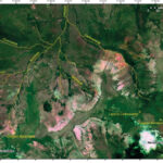
At 7:15 a.m., the first tepid sun rays begin to glimmer on the peaks of the Andes. A few minutes later a blinding disc of light, once worshipped by the Incas, the ancient inhabitants of this land, rises up to rule again, and we are filled with new-found optimism. We are 200 kilometers to the south of Cuzco, and the same distance east of Lake Titicaca and west of the Pacific Ocean.
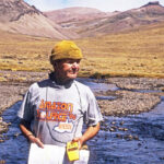
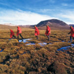
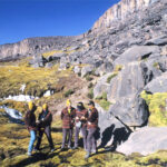
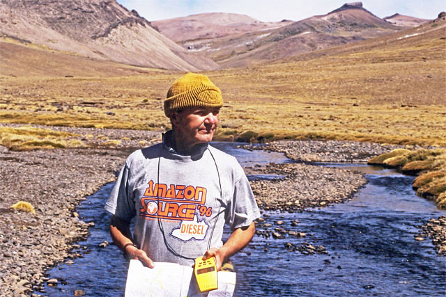
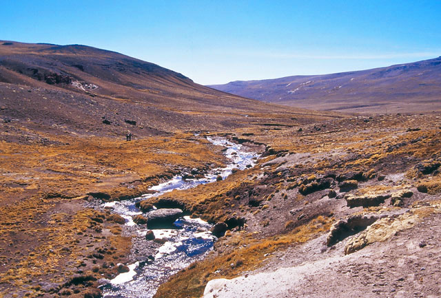
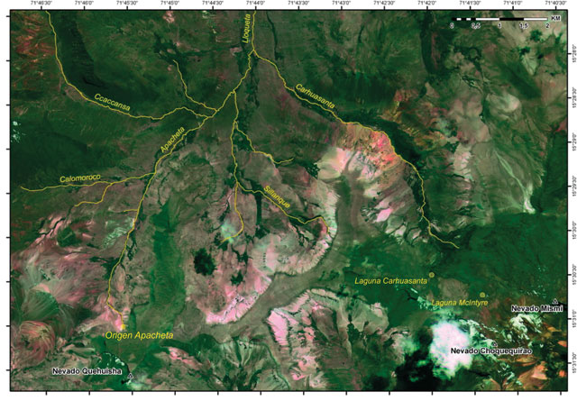
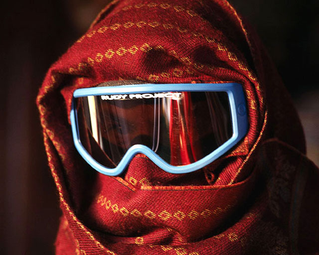
We climb up a path along the Carhuasanta. The surrounding landscape, marked by a vast network of tiny streams, makes a very complicated hydrological picture. It’s even hard work breathing, given that we are 5,000 meters high, and we often have to stop to give our lungs a rest. The lack of oxygen slows down body functions and as a remedy, we chew on some coca leaves. Every movement is carefully calculated so as not to waste energy.
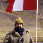
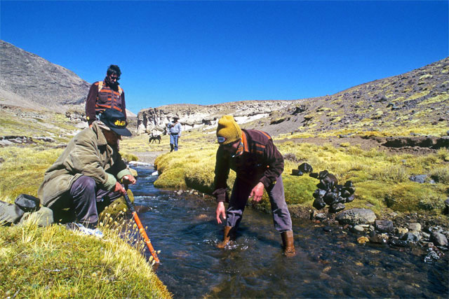
Our work consists in measuring all the streams in the upper Apurimac regarding length and flow (i.e. the volume of water that passes through a section in a given time). Only in this way will it be possible to locate the tiny rivulet giving rise to the mighty Amazon.
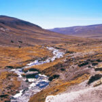
Five kilometers long, the valley is closed by a granite rock face. On its slopes covered with spongy terrain there are an infinite number of springs. Further up to our left, we note a cross with a plaque in honor of McIntyre, marking the presumed source of the Rio.
With the GPS satellite computer, we work out that this location is at least three kilometers away from the geographical position announced by the American. The confusion grows greater when we consider Penaherrera’s idea; his source is six kilometers away.
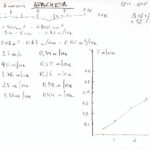
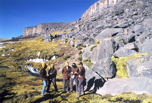
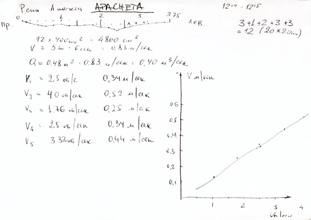
The next day, Dr. Serghey Ushnurtzev and his assistant Rimma Khajrutdinova work out that the volume of the Carhuasanta is only 65 liters per second as opposed to the 150 L/sec of the Apacheta. We carefully check the satellite SPOT image, that of the European Space Agency and the Russian Priroda satellites. We also acquire more geomorphologic knowledge about the area. Rimma stresses that McIntyre, who at all costs wanted to find the source furthest away from the delta, had indicated an insignificant stream without following hydrographic criteria. In fact, an infinite number of trickles flow down the two sides of the valley of the Carhuasanta and only join up at the valley bottom, gouging out a visible natural bed, which may be the beginning of the river.
“This doesn’t really matter, if we observe the longitudinal profile of the Carhuasanta and the Apacheta,” chips in Zaniel Novoa from the Catholic University of Lima. “The first of the two rivers in its average course goes down a sharper slope, which proves it should only be considered as a tributary of the larger river.”
Admiral Guillermo Faura gets straight to the point: “yes, you’re right, but the most important factor is that the Apacheta has a larger flow and it is also longer. What’s more it rises at an altitude no lower than the other one, as you can see from the satellite images.”
The next day, our research follows another two streams, the Ccaccansa and the Sillanque, which turn out to be less important. Now all our interest is focused on the Apacheta.
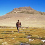
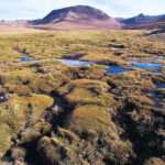
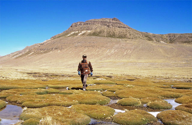
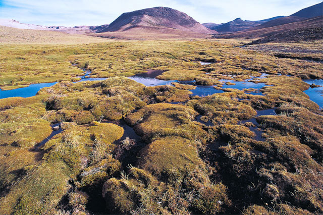
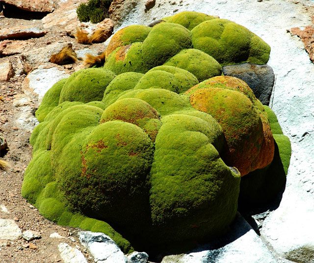
On the morning of July 16, 1996, we move upstream towards the source of this river. The previous night, the temperature fell to minus twenty-five degrees Celsius. Now it is around five degrees, and if it were not for the bitter icy wind, there would be nothing to complain about. We cross an area that rather resembles the Russian tundra made up of tiny islands with shallow water all-round covered with the round-shaped yareta, a bright green and very hard thick moss. It is an excellent fuel often used by local herdsmen. We then go up a mule track once trod by the Incas, one of the many ways through the Andes. The great Apacheta valley gradually closes in and the stream running through its center gets smaller. In the clear sky, a great Condor opens its wings like majestic sails spanning three meters and spirals up making the most of the air currents. At midday, we reach the Nevado Quehuisha. The glacier we saw in aerial photographs of the area taken twenty years earlier is no longer there. A few dozen meters before the crest, we catch sight of a green patch, no bigger than twenty meters, standing out from the grey of the surrounding sterile environment. From this muddy island, covered by tufts of ichu grass, crystalline water timidly gurgles up. It’s hard to believe that this trickle of water is the beginning of the world’s mightiest river.
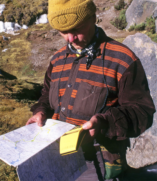
Renzo Grego, my travelling companion on a previous trip across Borneo, establishes our exact geographical coordinates with the Ensign GPS in a few seconds: latitude — 15°31’05” south, longitude — 71°45’55” west, the height is 5,170 meters on the eastern side of the continental watershed of Cordillera Chile, thirty-six kilometers south of the mining town of Cailloma in the region of Arequipa.
After flowing for around 7,000 kilometers for six weeks, the water gurgling up from under my feet will reach the Atlantic Ocean.